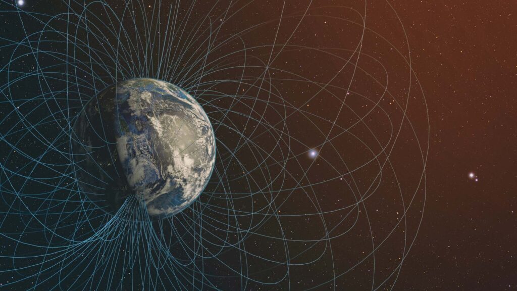

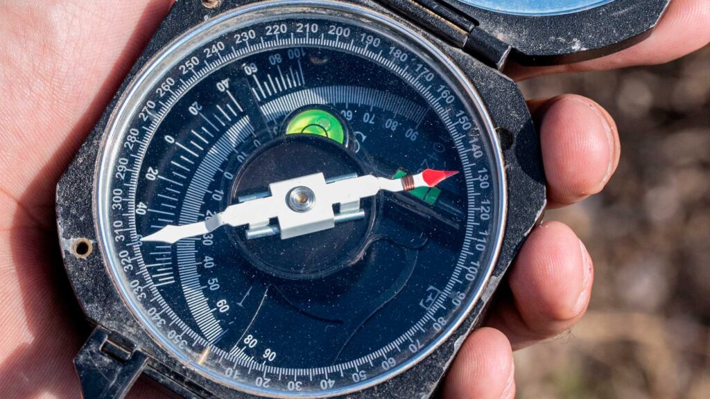
In the 17th century, when explorers and traders were discovering the immensity of the ocean, the first magnetometers, or compasses so to speak, were used to guide navigators and became an essential instrument for maritime transport. These devices, which responded to the earth’s magnetic north regardless of whether it was at night or in foggy conditions, allowed the ships of that time to locate themselves, take course and steer towards their destinations.
Los magnetómetros son una herramienta que ha existido básicamente desde que existen las brújulas, por lo que han Since compasses were invented, magnetometers also emerged, which is why they have been able to evolve through the different technological generations, this has made it possible to use them not only for navigation, but also for geophysical exploration.
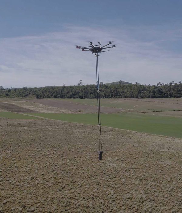
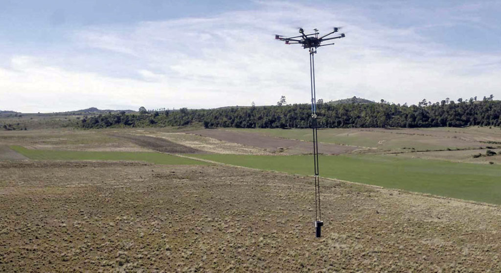
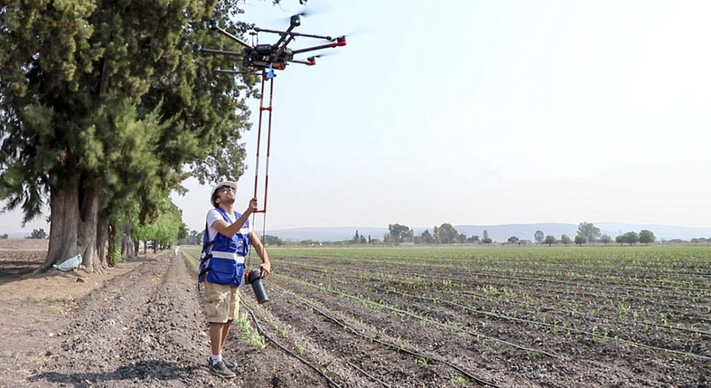
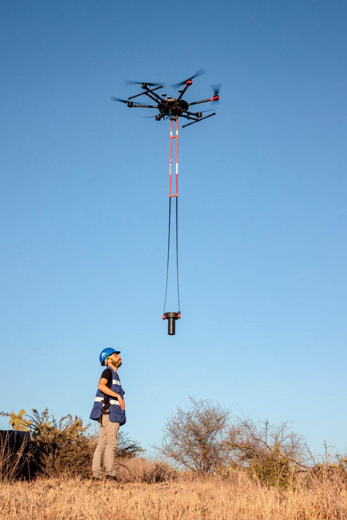
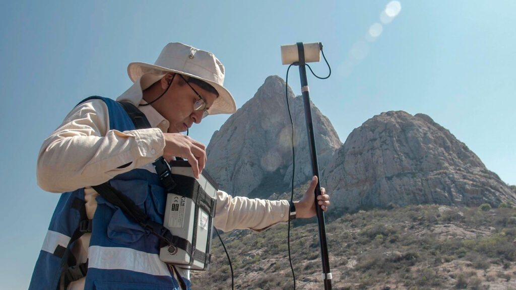
In AV3 AEROVISUAL we have the latest technology in mobile magnetometers, these devices are a great tool for the exploration and location of natural resources.
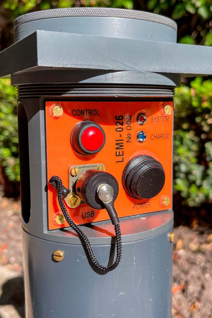
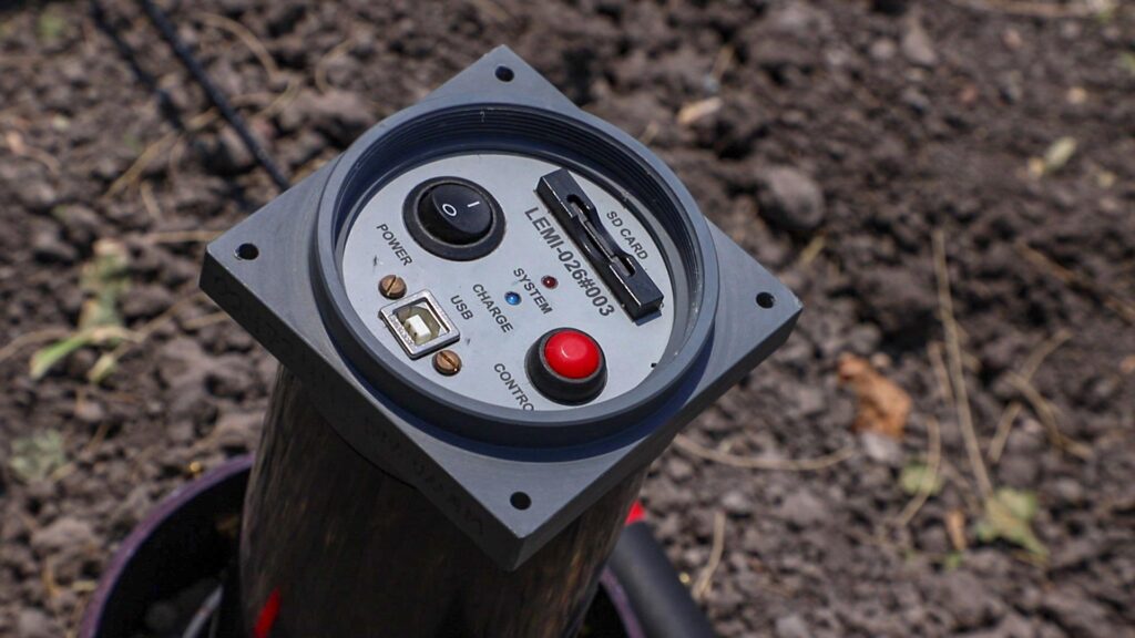
Nowadays we have the second generation of aerial magnetometers, which are renewed and improved based on the experience and results that we have been able to obtain in the last years and after having done research work with the Lemi026 model.
These magnetometers produced by the National Academy of Sciences and State Space Agency of Ukraine, designed for drone data acquisition, have a high accuracy and assembly which allows us to perform surveys with high sampling density at high speed.
Here we mention the most common magnetometers used for geophysical exploration, their characteristics and the principles under which they operate. Among them is the explanation of the Fluxgate, type magnetometers, this type of technology gives more detail of the magnetic components and is also the technology we use at AV3 AEROVISUAL. An example of this is the geothermal field research project, the aeromagnetic system with drones for geophysical exploration and our service dedicated to aeromagnetometry with drones.
MAGNETOMETERS FOR GEOPHYSICAL EXPLORATION
In general, the most commonly used magnetometers in geophysical exploration are: The Proton Magnetometer, based on the oscillation of H2O molecules; The Cesium Magnetometer, based on the Zeeman effect; and the Fluxgate Magnetometer based on direct magnetic induction in a highly permeable material.
TYPES OF MAGNETOMETERS
Most common types of magnetometers based on different physical principles. (Macintyre, 1999)
| TYPE | RESOLUTION (nT) | USES AND CHARACTERISTICS |
| Optical Zeeman | 104 | -Used for strong solar fields |
| Classic variometer | 10-1 | -Used in many observatories -Generally less sensitive -Poor response to pulsations -Due to its simple design, it is very reliable |
| Fluxgate | 10-1 | -Present in almost all modern observatories -Use in satellites for weak fields -Sensitive to stress and temperature -Low-noise versions exist for pulsations |
| Protons | 10-1 | -Ideal for total field measurements -Poor response to pulsations -Used for reference purposes in observatories -Extensive use in the field of geophysics. |
| Optical Pumping | 10-2 | -Total field measurements -Used in satellites -Complex electronic design -High measurement frequency -Wide frequency range |
| Induction loop | 10-4 | -Measures the rate of change of the field -Low measurement frequency -Used on some satellites -Ideal for measuring pulsations |
| Ground current probe | 10-5 | -Good for geological surveys -Good for pulsation measurements -Very simple design -Difficult to calibrate |
| SQUID | 10-5 | -Extensive use in rock sampling -Very complex electronics -Evaporation of liquid helium proble |
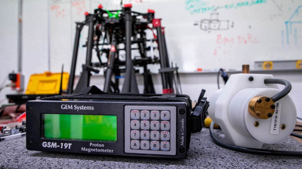
Proton Magnetometer
Proton magnetometers were developed almost at the same time as Fluxgate magnetometers, but are based on a different physical principle in their measurement. Their construction and use are relatively simple, which makes them a widely used instrument in geophysical survey work (Lowrie, 1997). The main part of this instrument consists of a container in which there is a large amount of hydrogen atoms, which are excited by an artificial magnetic field produced by a coil. Once the exciting current is interrupted, an interaction occurs in the coil between the hydrogen atoms and the local geomagnetic field, producing a twist of the atomic spins called “precession”. By measuring the frequency of spin oscillation, which is proportional to the field strength at the site, it is possible to know the magnitude F of the total magnetic field.
The precession frequency is around 2,000 Hz for an Earth field of about 50,000 nT, which can be measured with a digital counter in absolute value of the total field strength with an accuracy of up to 0.1 nT. The proton magnetometer measures only the magnitude of the magnetic field vector, the direction of which is nearly parallel to that of the undisturbed vector, i.e., it measures the total magnetic field plus the component of the disturbance in the direction of the total field (Breiner,1973).
One of the main characteristics of this type of magnetometer is that the measured data are independent of the sensor orientation, which allows the magnetometer to be operated without regard to its orientation, allowing for mobile operation. In addition, proton magnetometers have a good resolution and enable digital display of the measurements in real time. However, since they only measure the magnitude of the total magnetic field, it is impossible to analyze the individual components if this is necessary, and the signal decreases abruptly in the presence of a very strong magnetic field gradient, i.e. greater than 600 nT per meter. The amplitude of the sensor signal is of the order of microvolts and must therefore be measured with an accuracy of 0.4 Hz, which is difficult to measure in the vicinity of alternating electrical currents and therefore in urban areas it is difficult to obtain good data.
Optically pumped magnetometer
In this type of magnetometer light, with a suitable wavelength, is absorbed by an alkaline vapor cell (Campbell, 2003). With such absorption, the higher energy levels are charged and remit energy to the lower levels. Some of this remission follows a “forbidden” pathway to a level that is known to be sensitively changed by the local electromagnetic force. When absorption stops due to the full charge of that particular energy state, radiofrequency waves within a range determined by that “forbidden” level may drop in level so that it can become absorptive once again. The rubidium cell switches between transparent and opaque, responding to a light source oscillating at the preceding Larmor frequency (Liang, Z.P. and Lauterbur P.C. et al., 2000), which corresponds to the selected energy level that is able to change position with the local electromagnetic force. More accurate rubidium magnetometers have now been developed that isolate a single energy sublevel.
El Magnetómetro de rubidio común tiene una sensibilidad limitada a aproximadamente 0.2 nT. El magnetómetro mide The common rubidium magnetometer has a sensitivity limited to approximately 0.2 nT. The magnetometer measures the total field and variations along all directions of the field. The advantage of this instrument is that it operates well in weak magnetic fields and has a fast response time, which gives it a better use on satellites. The main problem with the instrument is the short lifetime of its absorption cells and the complicated circuitry of the instrument. Helium is also used in optical pumped magnetometers. The low radio frequency electric field of these atoms can be excited to a metastable state that has a relatively long lifetime and is split into sublevels by the effect of the magnetic field in the environment. From this ground state, pumping and detection of the geomagnetic field, from this state, is similar to that described above for rubidium cells. Commercial helium magnetometers are reported to have a sensitivity of about 0.01 nT (Macintyre, 1999).
Fluxgate Magnetometer
Fluxgate magnetometers are so called because of the way they periodically intersperse the measurement of magnetic sensors by changing their magnetic flux. In this type of instruments, the heterogeneity of the high permeability magnetization properties found in ferromagnetic particles can be used as an indicator of the local field strength (Primdahl, 1979).
The instrument consists of two parallel cylindrical cores of a high magnetic permeability material with windings in series, but in reverse direction, so that when an electric current passes through them the fields produced are equal and in opposite directions. If a sinusoidal alternating current of intensity I is applied to the windings of these cores, the magnetic field B inside them will follow a hysteresis cycle produced by the inductor field H. Assuming a perfect symmetry of the device, the fields produced in both cores B1 and B2 are equal and of opposite sign so they cancel each other out, if a coil were placed around both cores no current would be induced in it. However, if there were an external magnetic field Ho, smaller than H and parallel to the axes of the cores, such that when superimposed on the field produced by the current I the maximum value of the inductor field fulfills that Ho ± Hm > Hs (Hs is the value of the inductor field necessary to reach saturation and Hm the maximum value of the field produced by the current I), the saturation state of the cores will be reached in one half-cycle but not in the other. Therefore, when approaching the saturation point the B1 flux will vary more slowly than the field, the same would occur with the B2, flux, but there being a lag with respect to the former, a maximum with frequency twice that of the inductor field arises as a consequence (Primdahl, 1979; Kearey et al., 2011).
Since the total magnetic field can be expressed in terms of its individual components, and the fluxgate magnetometer allows to measure the intensity of each component of the field, then it is possible to obtain the magnitude of the total field from the individual magnitudes measured simultaneously from:
|B| = (Bx2+By2+Bz2)1/2
Its use is mainly in static measurements, i.e. fixed, because the use of this type of magnetometers in a mobile way presents a number of details that must be taken into account in order to have a proper interpretation of data. But thanks to advances in electronics, they have been substantially reduced in size, making them very compact and lightweight, in addition to having inclinometers which record the deviation of the sensors of the equipment if it is displaced from the vertical. In addition to being able to measure the three components of the magnetic field, this type of magnetometer has the possibility of obtaining measurements in very short time intervals
If you want to know a little more about the history of magnetometers, we suggest you read the article; What is magnetometry and what is it for? a must read to better understand the origin and purpose of this technology.
In AV3 AEROVISUAL we offer consultancy and aerial magnetometry services with drones for exploration and search of resources. Write us at contacto@av3aerovisual.com or call us at 442 129 7892 and let our experts advise you and together find the best solution for your budget.