

When we talk about magnetometry with drones, we must consider the challenges presented by the application of this geophysical method. When mounting a magnetometer on a drone, either total range or fluxgate, we find electrical components, magnetic materials, even the movement of the drone motors, which generate magnetic activity that can easily cause alterations in the acquisition of data, preventing accurate and useful results for the regional characterization of mineral resources.
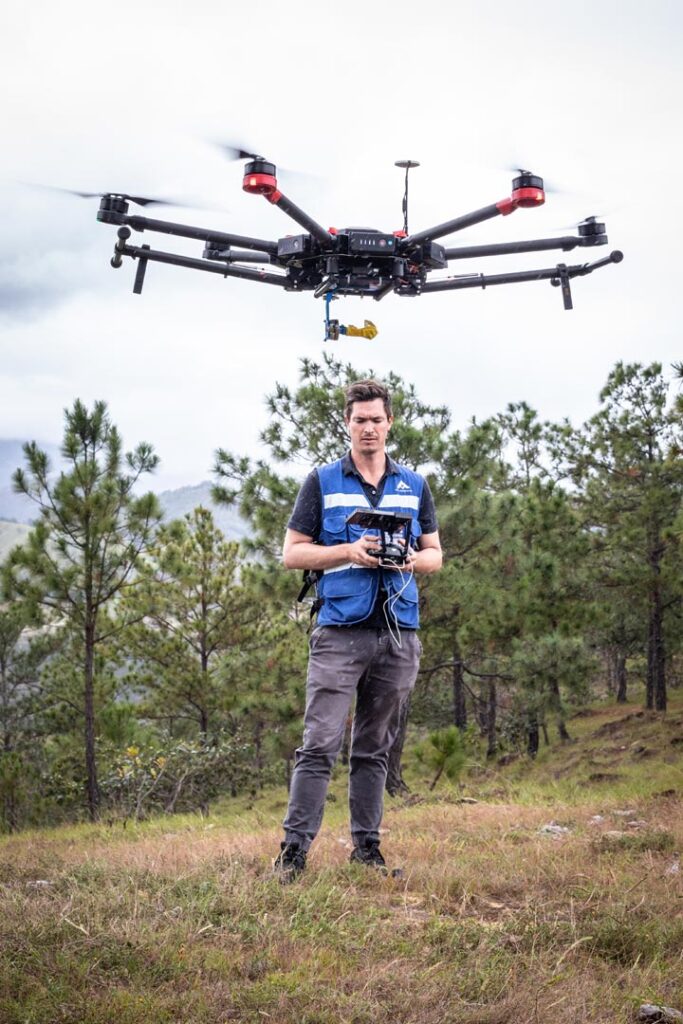
· Drones with custom-made fluxgate magnetometers for aerial data acquisition.
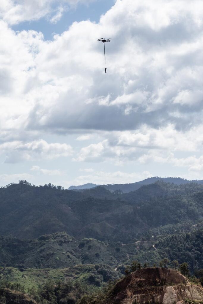
· Aerial inspection with drones for large extensions of land and difficult access areas.
· Reliable results, in less time and at a highly competitive cost.
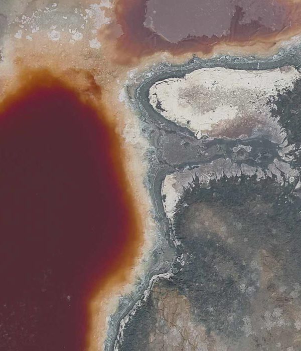
The search for minerals with high magnetite content such as iron or nickel, are the ideal scenario for this type of applications, however, the search for high value non-magnetic minerals such as gold and silver, find great benefits through the application of geophysical methods such as magnetometry with drones, with the determination of magnetic highs and lows.
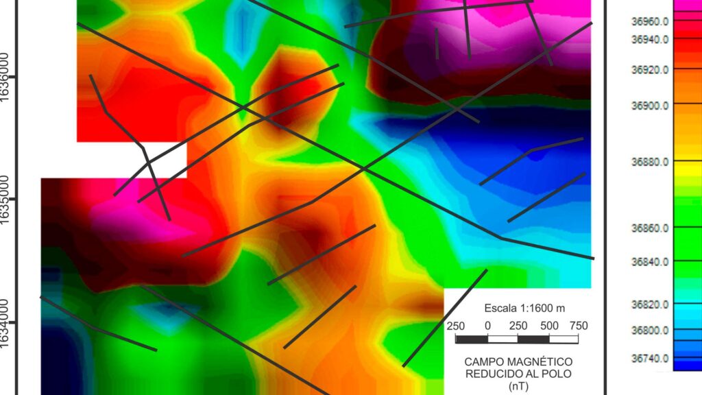
Therefore, our AV-MAG℠ aeromagnetic acquisition system is currently the best for generating anomaly maps of large areas, adapting to terrain topography and flying where other aerial vehicles cannot fly. The triaxial fluxgate magnetic sensors we use allow us to generate redundant databases, in contrast to full-field proton sensors. The measurement of the individual field components allows us to more precisely delimit anomalous areas of economic interest. In this way, we generate information that allows us to make timely exploration planning, in a short time and with completely accessible costs.
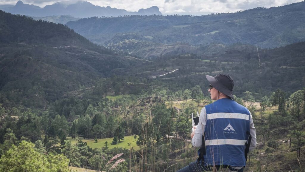
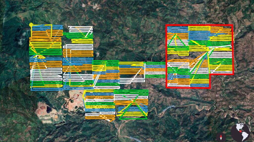
Currently, we can inspect up to 600 hectares with a single operations team, and with our data cleaning software we can deliver preliminary results in less than a week after the survey is done. To date, in AV3 AEROVISUAL we have taken our solution to different parts of Mexico and Latin America, having generated magnetic anomaly maps over surfaces totaling thousands of hectares in extension.
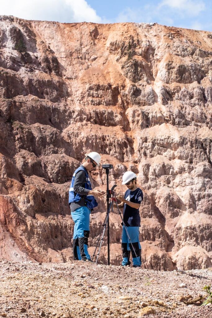
Magnetic prospecting with drones is a unique solution with great economic benefits for the mining sector since it is a powerful tool to effectively and quickly locate the areas with the greatest mineral potential in order to delimit them and to make their extraction more efficient. In addition, it is possible to apply other complementary geophysical methods such as AMT (audio magneto-telluric) and gravimetry, to obtain greater certainty of the viable zones for exploration and extraction of resources, in addition to the possibility of generating robust and reliable models for the planning and definition of zones of interest.
AV-MAG℠, OUR DRONE MAGNETOMETRY SOLUTION FOR MINING
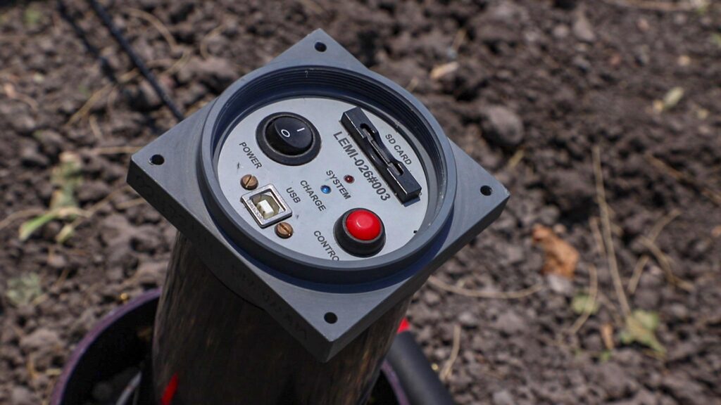
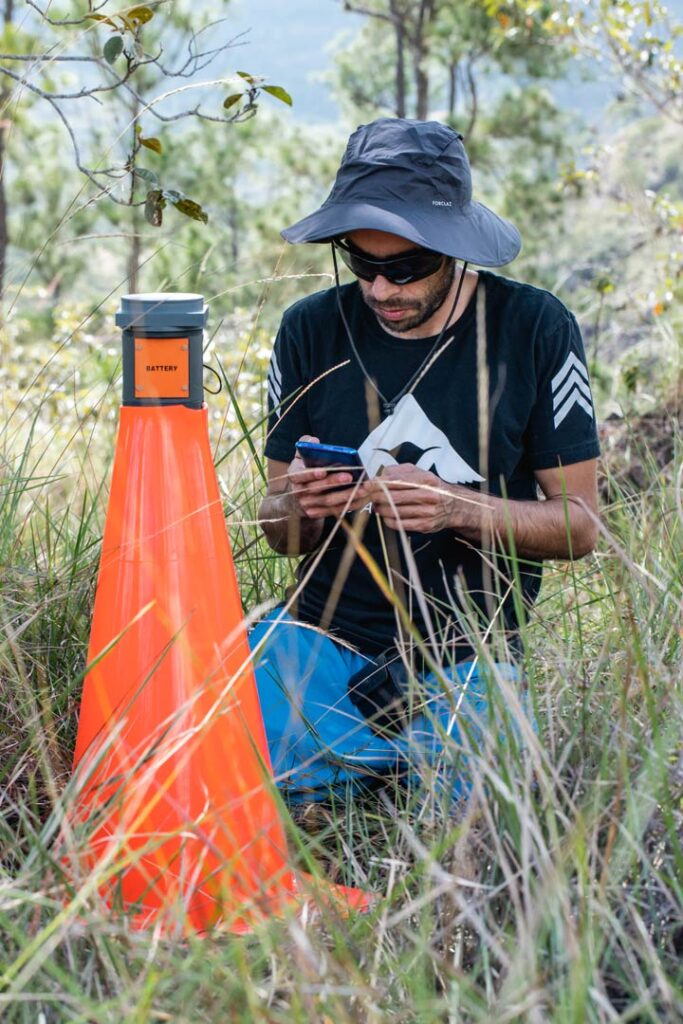
Since 2014, AV3 AEROVISUAL together with UNAM, has been involved in the development and design of LEMI-026 magnetometers manufactured at the express request of the Laboratory for Electromagnetic Innovations of Ukraine, specialized in the manufacture of satellite instrumentation, including magnetometers.
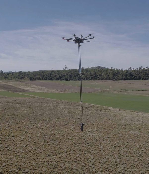
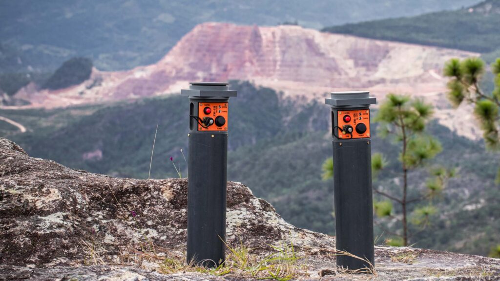
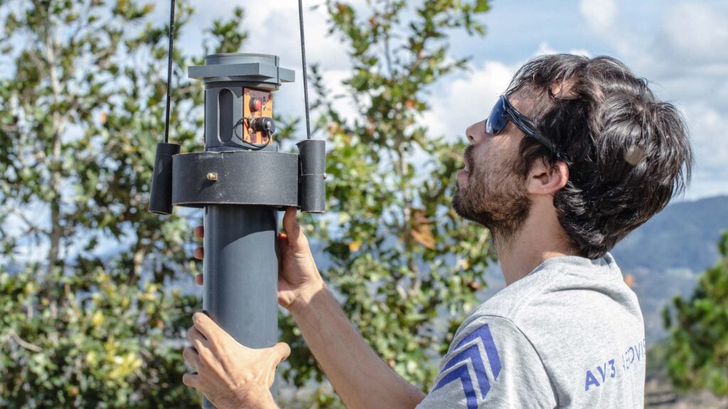
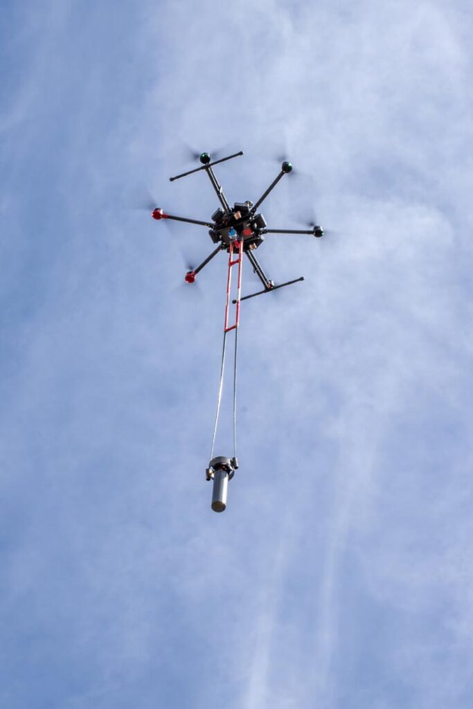
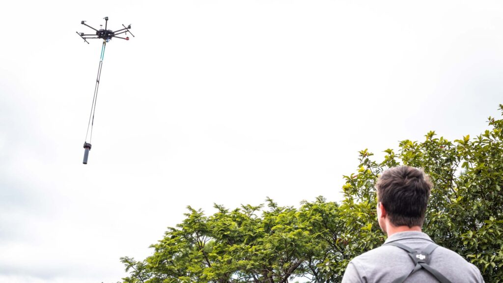
Currently, we have jointly updated two versions of fluxgate magnetometers with the capacity to acquire 200 samples/s in each of the three components of the field (X, Y and Z) in addition to measuring their geopositioning, date, time, inclination and vertical deviation (tilt) for a correct interpretation of data. Likewise, this equipment has a design that eliminates the magnetic interference that the drone generates on them.
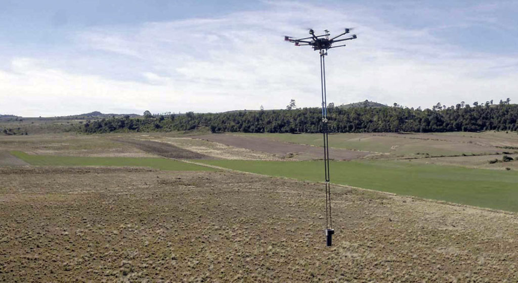
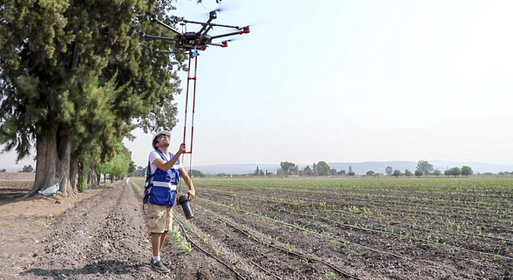
Para asegurar la verticalidad y orientación del magnetómetro durante el vuelo, se diseñó e implementó un To ensure the verticality and orientation of the magnetometer during flight, a non-magnetic stabilizer was designed and implemented that allows us to move the magnetometer up to 3 meters away from the drone. This stabilizer allows us to keep the sensor vertical with respect to the ground, thus wind traction and dragging by the movement of the drone during the flight considerably reduces the tilt and significantly improves data quality, resulting in reliable information of great value for decision making.
At AV3 AEROVISUAL we know that the knowledge we share, as well as the technology and methods we use, offer benefits that provide value and intelligence in decision making. Learn more about what magnetometry is and what it is used for, what are the types of magnetometers, uses and characteristics. Do you have a project in mind? Learn more about aerial magnetometry with drones and decide to be really competitive with our aero magnetometry service with drones.