Loading...
Loading...
Uncategorized
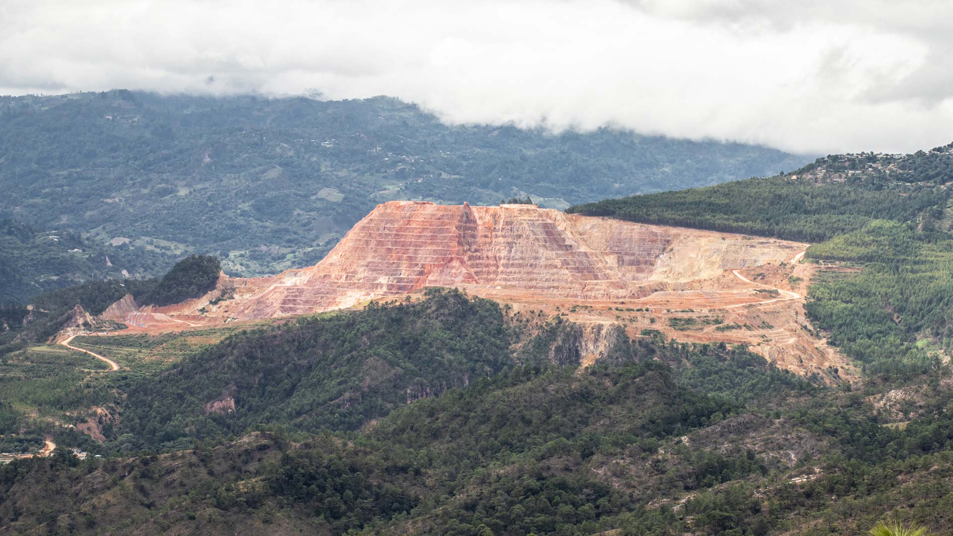
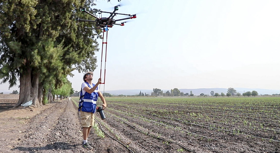
Our service for the mining sector focuses on the regional characterization of magnetic activity, adapting to the topography of the terrain and allowing its correct measurement, at high altitudes and obtaining accurate readings for interpretation.
Geophysics and exploration| News
Aerial magnetometry with drones for resource search and exploration; technical talk by AV3 AEROVISUAL at the International Mining Congress, Sonora, Mexico.
Geophysics and exploration| Geophysics and exploration| Geophysics and exploration| Geophysics and exploration| Geophysics and exploration| Industrial Solutions
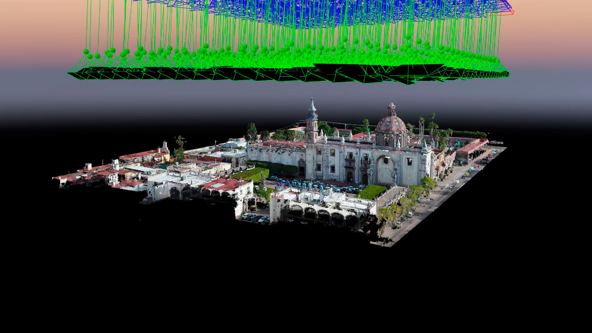
Aerial photogrammetry with drones allows the generation of 2D images, 3D surfaces, and three-dimensional digital models. Photogrammetry has applications in mining, geotechnics, geology, geophysics, civil works, archaeology, among others.
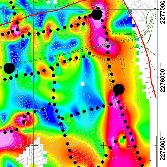
We implement geophysical methods for underground research and exploration. Natural resources and hydrocarbons, mining, construction, urban planning, public safety, archeology and agriculture.
Aeromagnetic system with drones for geothermal exploitation Master study of aerial magnetometry with drones for geothermal exploitation; by means of the comparison of telluric magnetic profiles in Humeros, Veracruz.
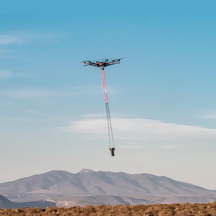
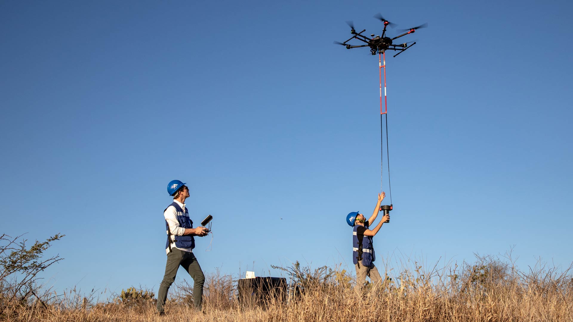
We are pioneers in aerial magnetometry with drones in Mexico. AV-MAG℠ is a high-tech geophysical exploration method for generating highly accurate magnetic anomaly maps.