
Magnetic prospecting is based on measuring the Earth’s magnetic field which is generated by the Earth’s core, which in turn is modified by the presence of temperatures and materials with magnetic characteristics. The magnetic field of the planet Earth is not uniform, therefore models are used to describe its behavior, these models tend to discriminate the local anomalies so a local magnetometric measurement yields data that serve for planning and exploration of a specific point as it could be a construction or a land extension.
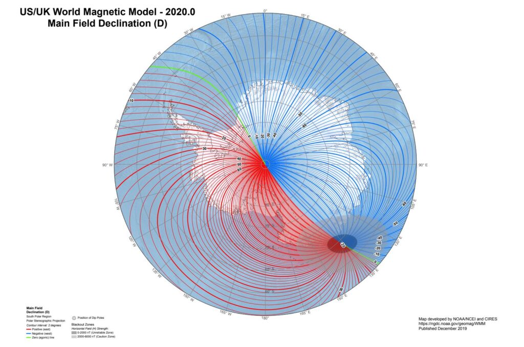
Source: National Centers for
Environmental Information
Brief magnetometer history
The history behind magnetometers for magnetic exploration is quite short, it began in the middle of World War II with the invention of electric magnetometers. The technological advance resulting from wartime led to the development of magnetometry as the components of magnetometers, such as chips, batteries and electronics in general, were reduced in size and price while increasing in accuracy (Reeves, 2005). This development also brought with it the creation of the proton precession magnetometer, the fluxgate type magnetometer, and eventually the optical pumping magnetometers, so one of the first uses of magnetometry would be for military purposes using them to search for enemy submarines in order to destroy them, thus becoming the first aeromagnetic surveys.
Magnetometric Applications
Magnetometric inspection has a wide range of applications such as:
- Search and characterization of oil, defining the geological limits and defining the depth of the foundation, just to mention a few.
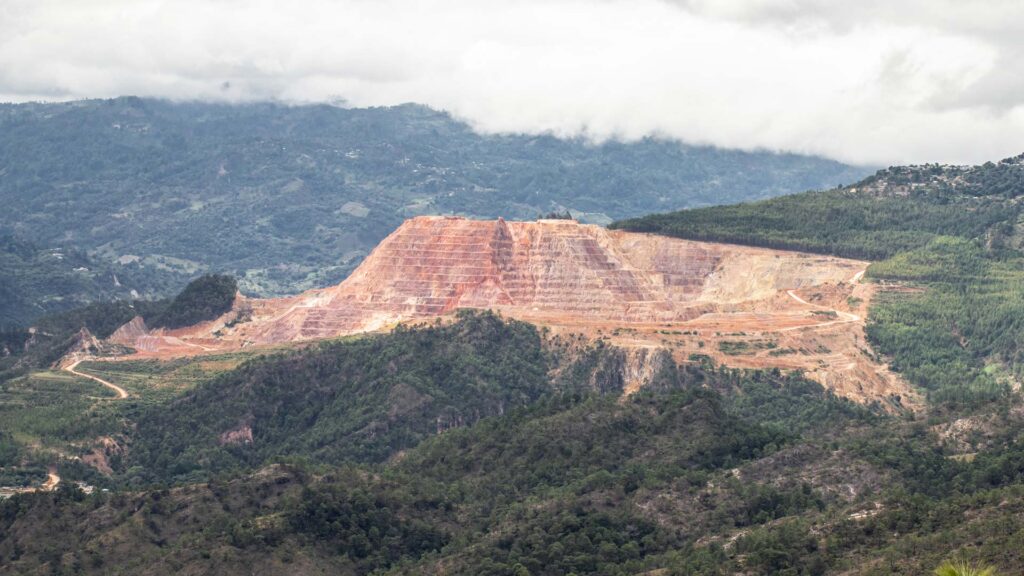
- Exploitation of mineral resources, identifying the areas of anomaly with magnetic minerals or contrasting to the environment.
- Search of geologic artifacts with magnetic signature as vestiges of war, bullets, bombs, mines (uxos)
- Characterization of aquifer system
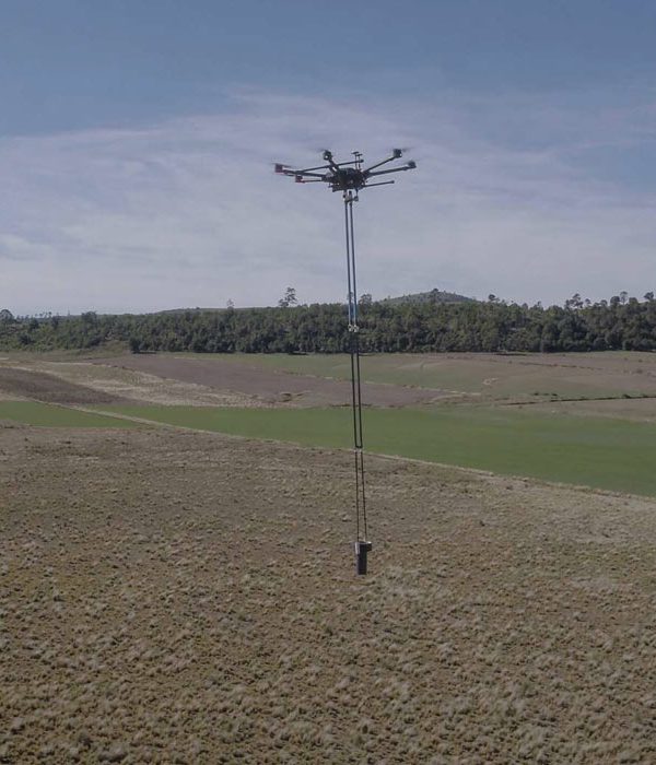
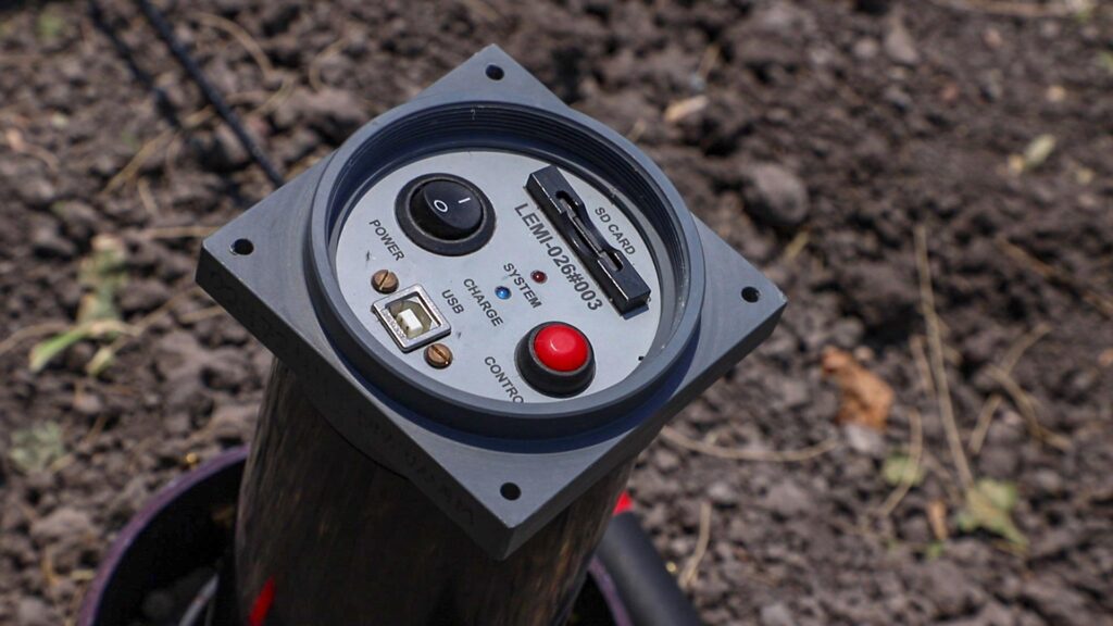
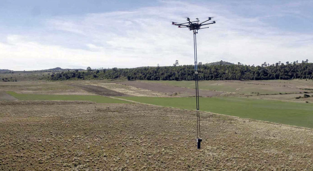
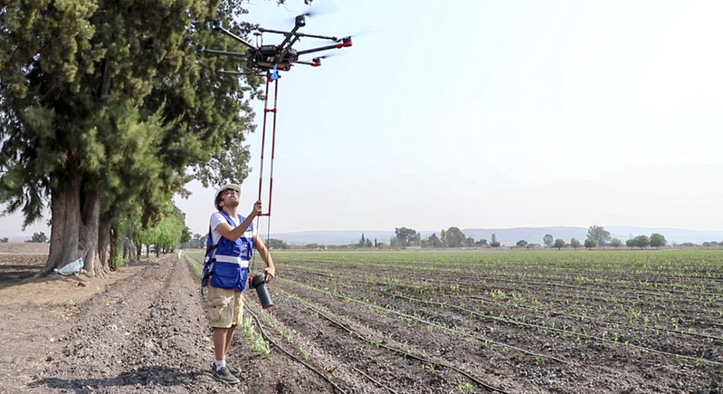
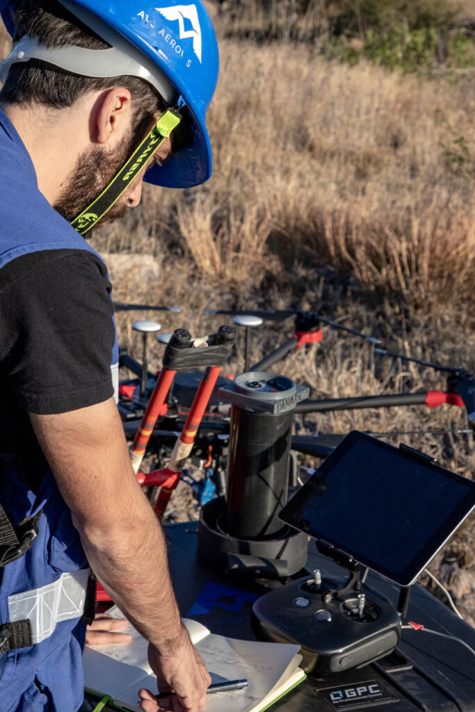
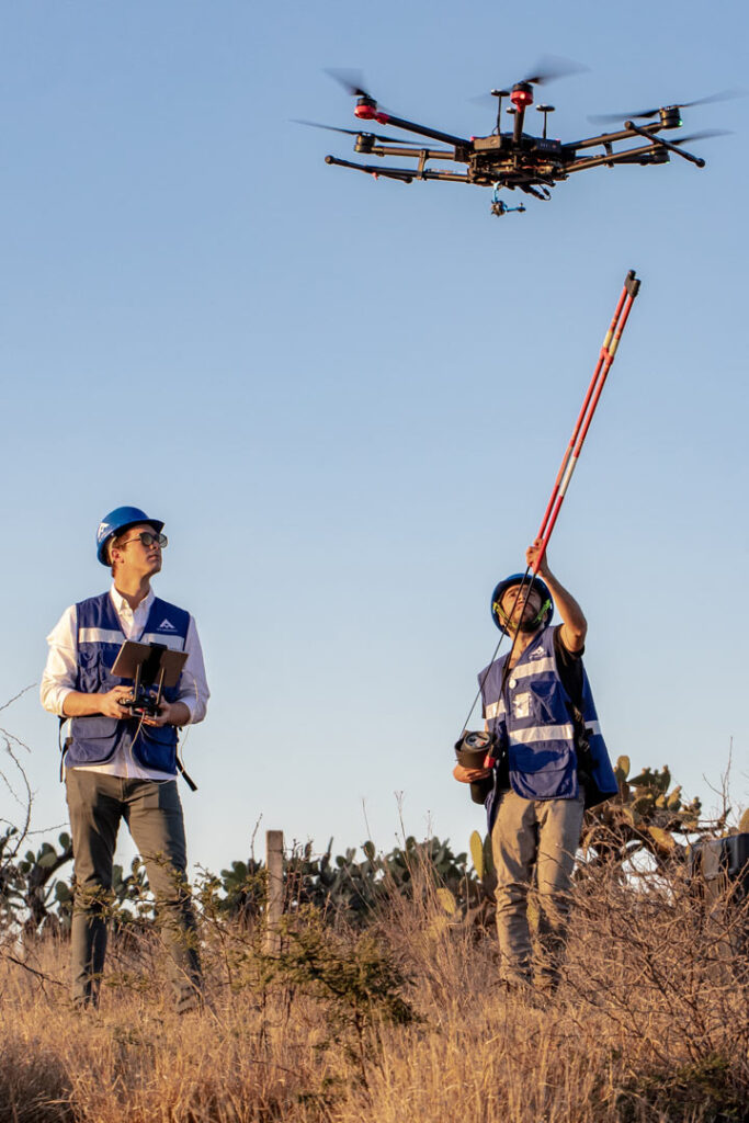
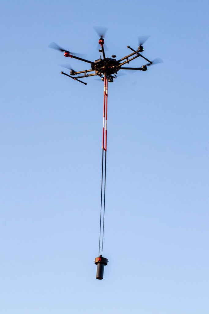
Nowadays, there is a great diversity of magnetometers used for geophysical exploration, where there are versions of very simple magnetometers which range from a simple bar of high magnetic susceptibility, to magnetometers that depend on super-cooled gases, generally being more precise but also more complex, although recent advances in technology have reduced their size, and decreased its costs. Because of these technological advances, it is now possible to make magnetometry with UAVs also called aerial magnetometry with drones.
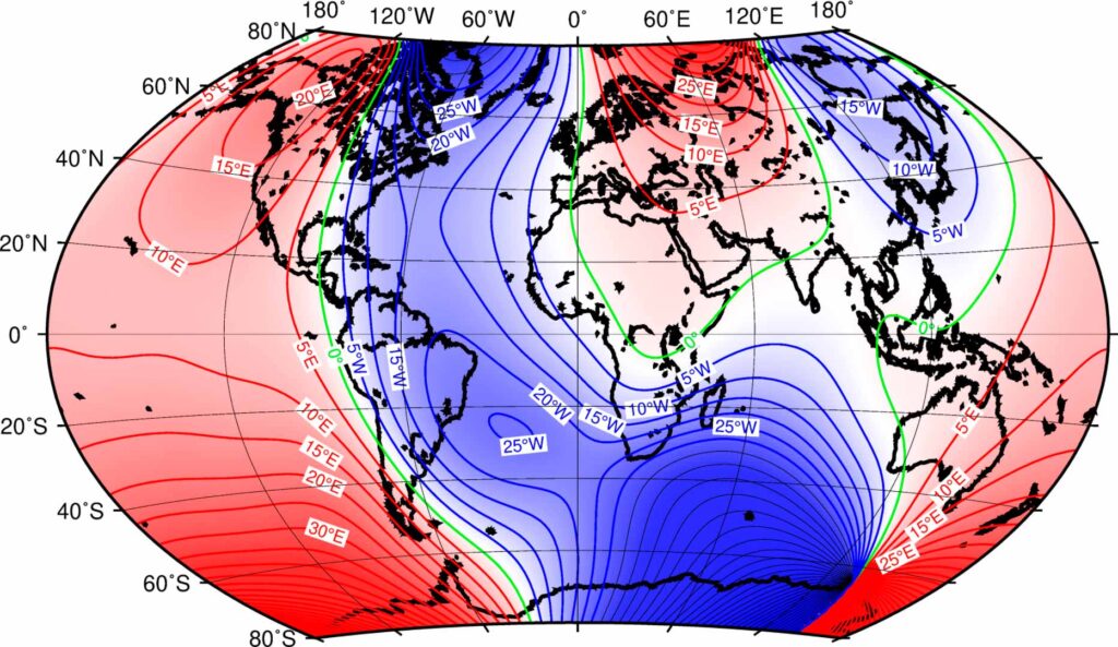
Source: British Geological Survey
Overall, the most common magnetometers for geophysical exploration are: the proton magnetometer, based on the oscillation of H2O molecules; the cesium magnetometer, based on the Zeeman effect; and the fluxgate type based on direct magnetic induction in a highly permeable material, but if you want to know more about how a magnetometer works, go to the link.
In AV3 AEROVISUAL we offer consultancy and aerial magnetometry services with drones for exploration and search of resources. Write us at contacto@av3aerovisual.com or call us at 442 129 7892 and let our experts advise you and together find the best solution for your budget.