Loading...
Loading...
As part of our services for geophysics and exploration, we use drones and geophysical technologies for the exploration and estimation of resources, identification of geological structures and soil studies. these services optimize resources and costs, automate and improve processes for planning and development of mining projects, exploration plans, geology management, geophysical investigation, drilling, mineral resource estimation, evaluation of geological and exploration projects, geological data collection, geothermal prospecting, establishment of lithological boundaries, topography, rock bed configuration, well and aquifer location.
All our services are insured and all our operators are licenced drone pilots.
Uncategorized
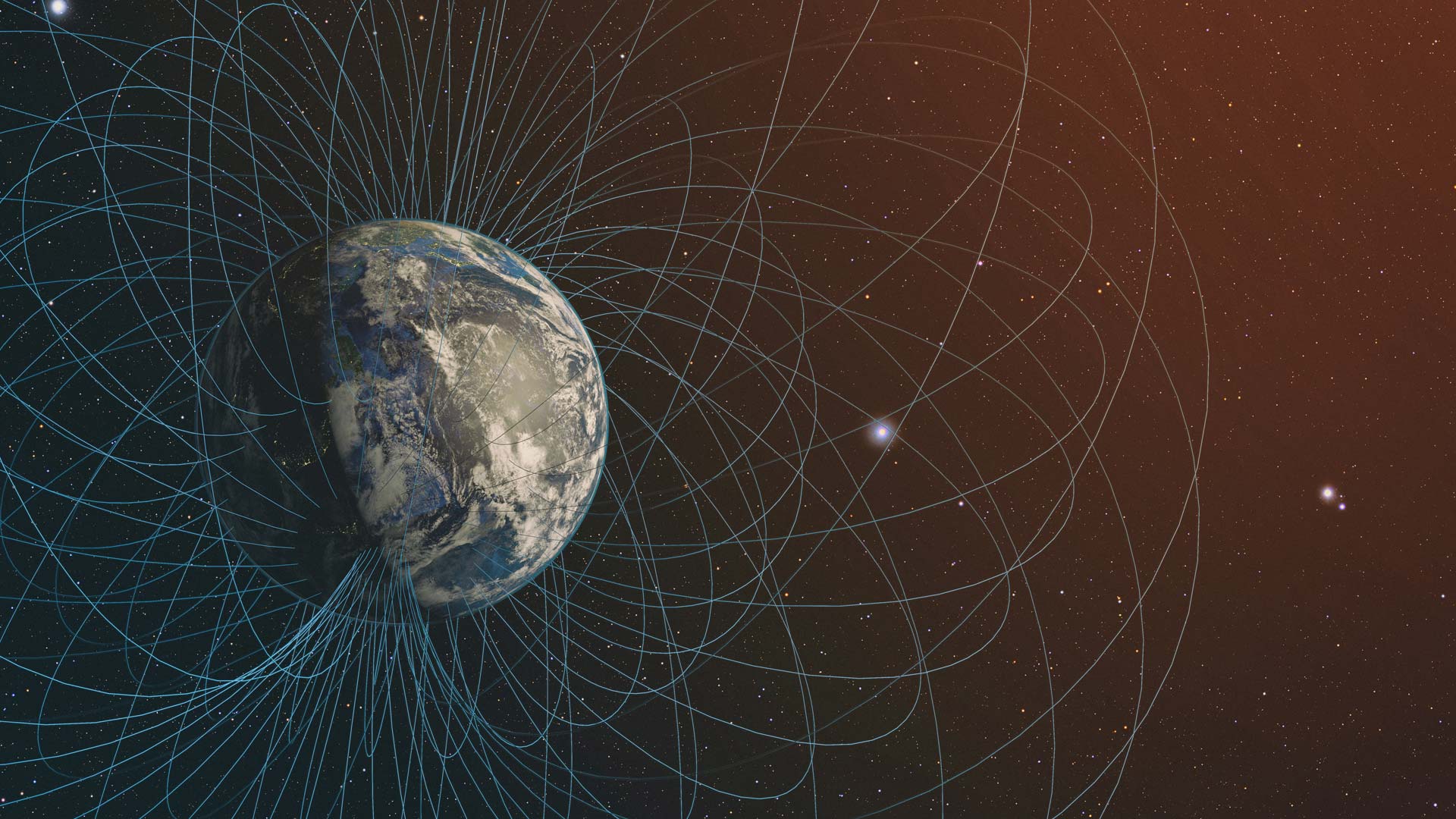
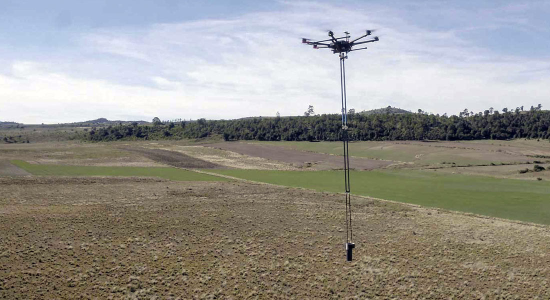
Magnetometric measurement and inspection yields data for planning and exploration. Its applications include oil characterization, mineral resource exploitation, search of magnetic artifacts, characterization of aquifers, among others.
Industrial Solutions| Precision agriculture
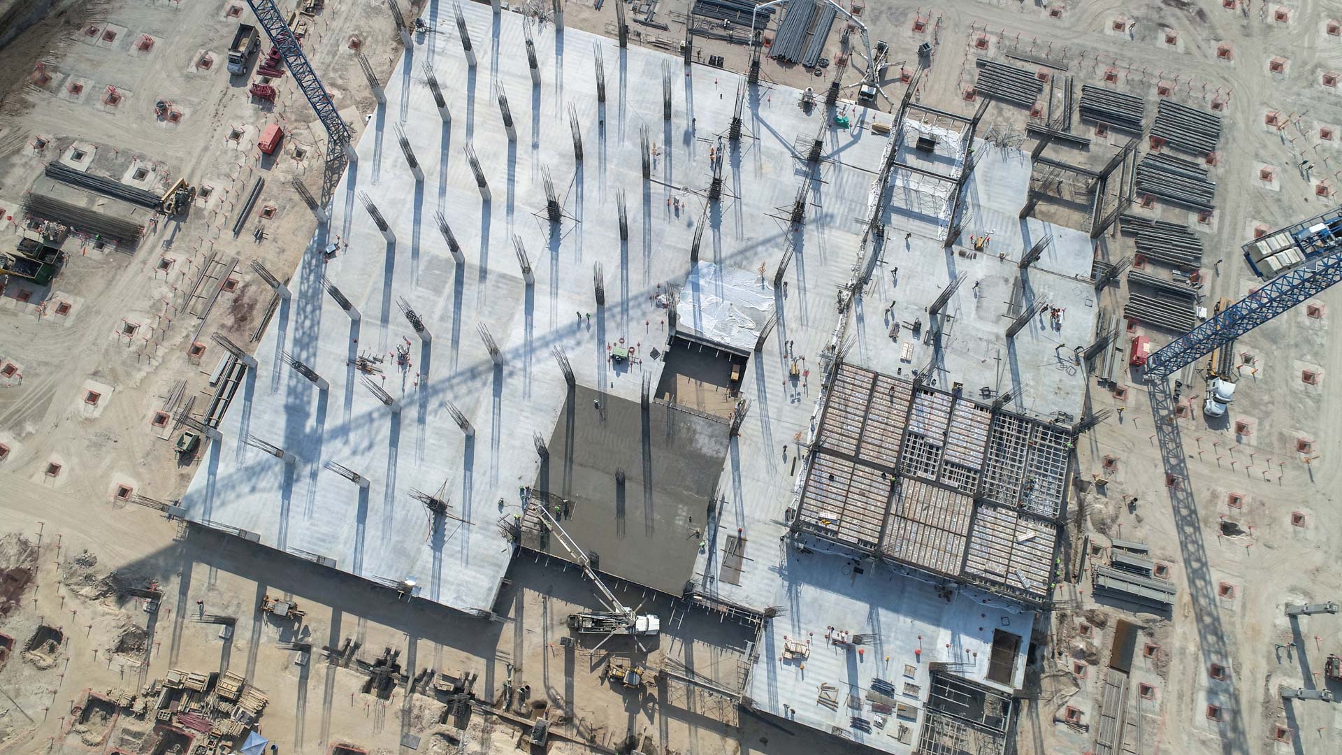
Aerial inspection with drones adds value and intelligence for different sectors of the industry, it is a review to prevent, detect or correct some kind of problem. By using a drone, qualitative and quantitative information can be collected from an asset or a location of difficult access, making the inspection safe and efficient.
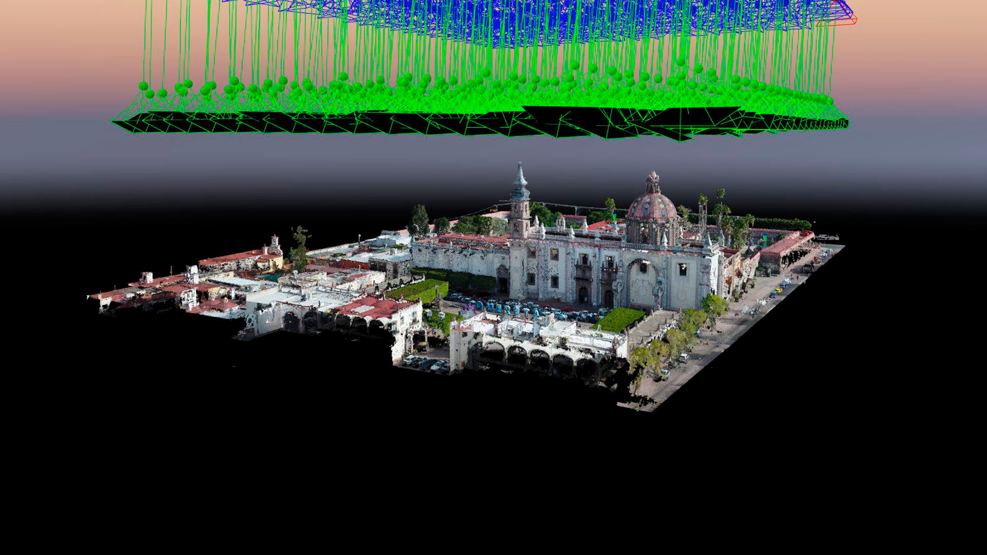
Aerial photogrammetry with drones allows the generation of 2D images, 3D surfaces, and three-dimensional digital models. Photogrammetry has applications in mining, geotechnics, geology, geophysics, civil works, archaeology, among others.

Photogrammetry with drones and stereoscopic image processing to generate 3D models used for the bronze model of the Historic Center of Querétaro.
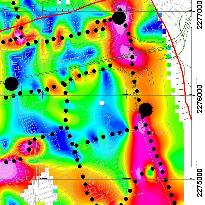
We implement geophysical methods for underground research and exploration. Natural resources and hydrocarbons, mining, construction, urban planning, public safety, archeology and agriculture.
Uncategorized
Development of aeromagnetic exploration system with Fluxgate-type magnetometers, transported by a drone in continuous acquisition mode, for the generation of polygons or profiles to obtain magnetic data in all types of areas. Collaboration with UNAM’s CEGEO, the Ukrainian Academy of Sciences and AV3 AEROVISUAL.