Loading...
Loading...

We participated in the webinar on Industrial Process Optimization in Latin America as part of the ambassador program of Pix4D, a leading company in the development of photogrammetry and mapping software with drones.
Geophysics and exploration| Industrial Solutions
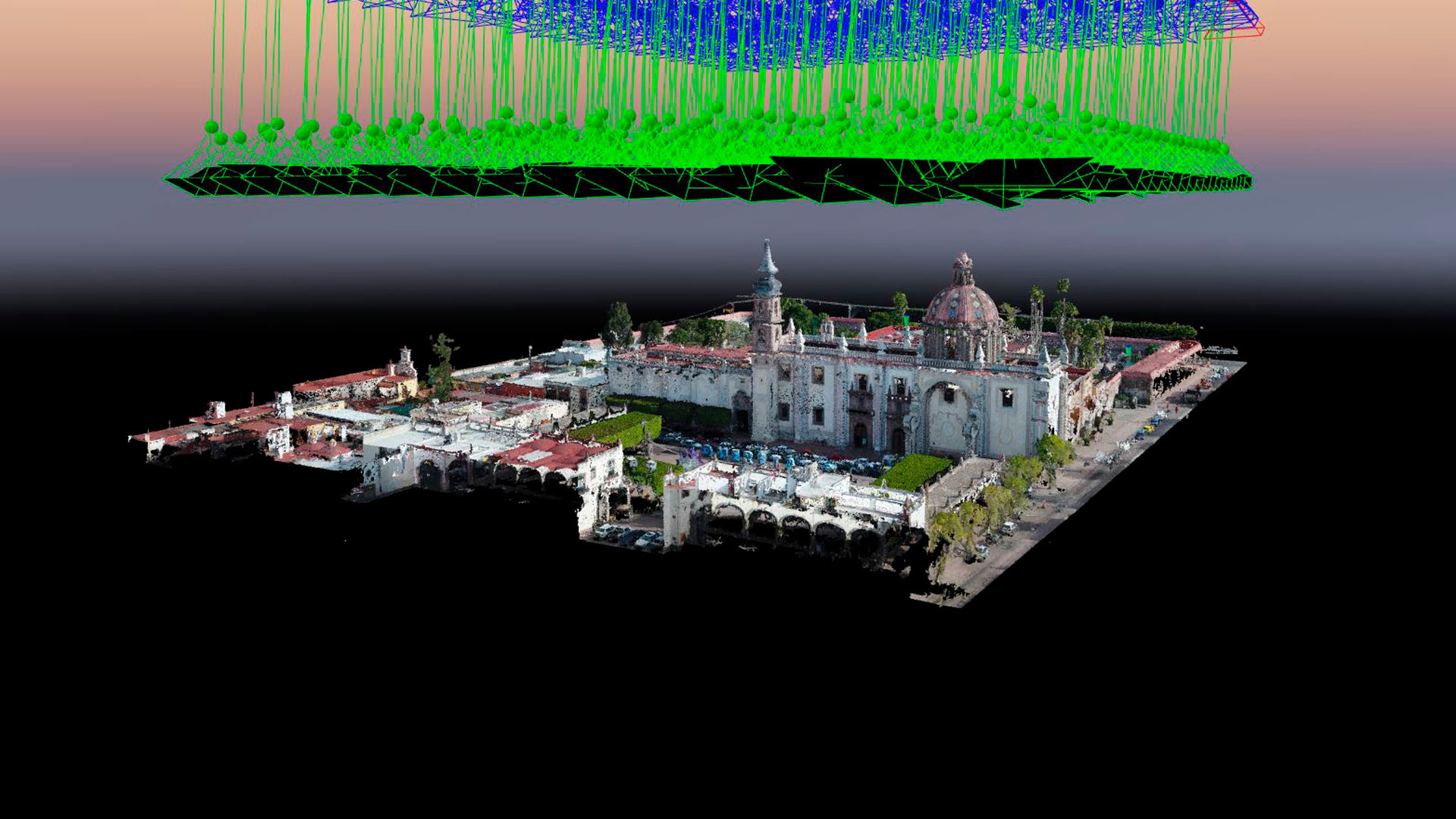
Aerial photogrammetry with drones allows the generation of 2D images, 3D surfaces, and three-dimensional digital models. Photogrammetry has applications in mining, geotechnics, geology, geophysics, civil works, archaeology, among others.
Industrial Solutions| Industrial Solutions| News
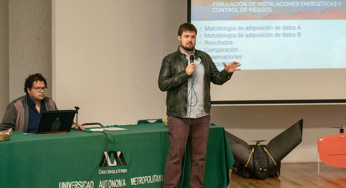
Aerial thermography with drones in photovoltaic plants, conference given at the second edition of Drones Fotogrametría Pro at UAM Iztapalapa.
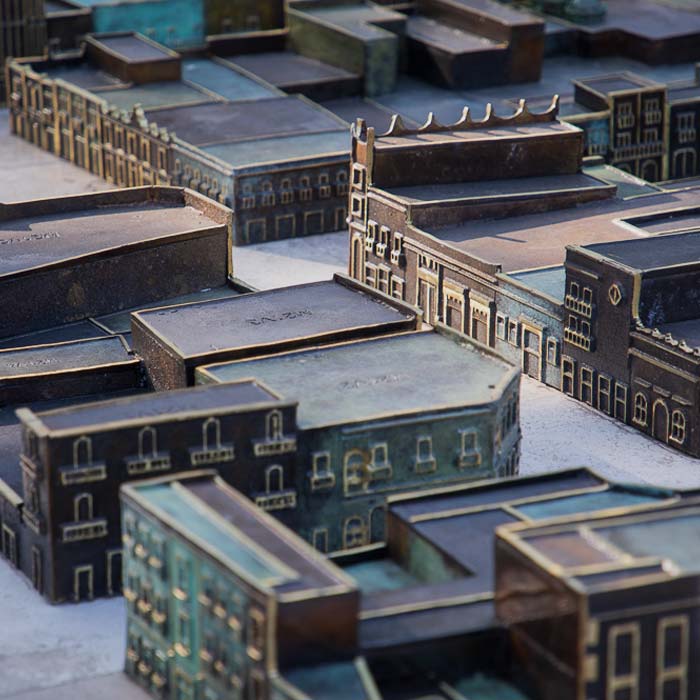
Photogrammetry with drones and stereoscopic image processing to generate 3D models used for the bronze model of the Historic Center of Querétaro.

Uncategorized
Drones Pro Photogrammetry first annual meeting, held at Tecnológico de Monterrey campus Guadalajara. The event gathered students, researchers, companies and representatives of government institutions and people interested or involved in the use of drones for geophysical studies.
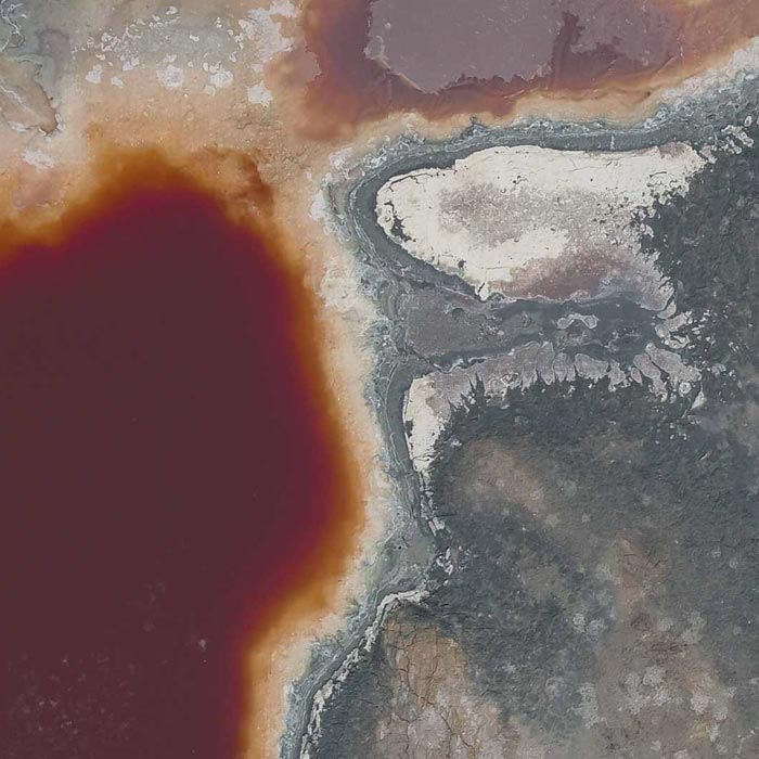
Photogrammetry for digital terrain model generation. Comparison of aerial magnetometry with drones and terrestrial, using microgravimetry and digital terrain model.