Loading...
Loading...
Video production for property and land sales, we create high impact advertising content to highlight the most attractive parts of your property or land.
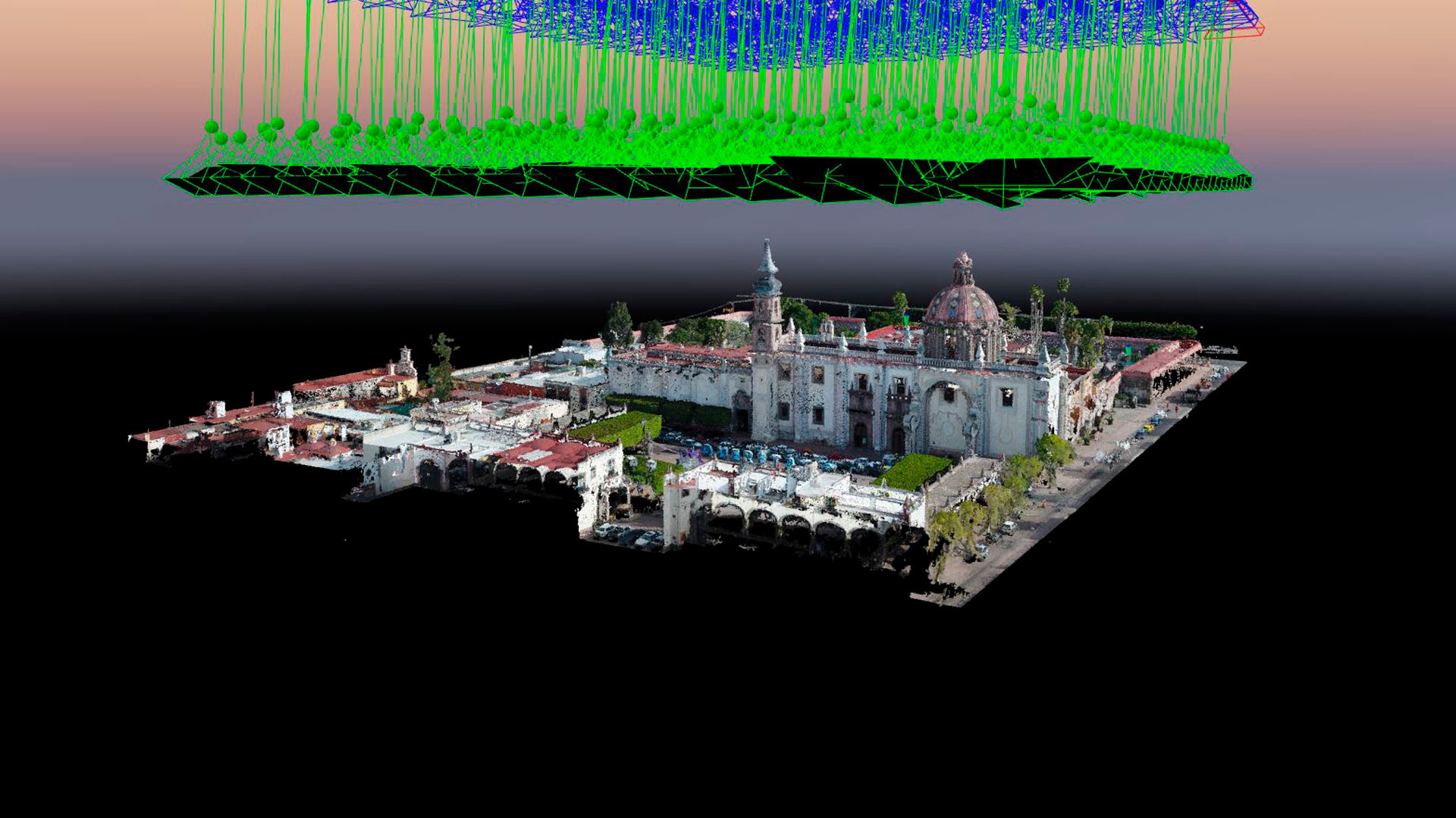
Aerial photogrammetry with drones allows the generation of 2D images, 3D surfaces, and three-dimensional digital models. Photogrammetry has applications in mining, geotechnics, geology, geophysics, civil works, archaeology, among others.
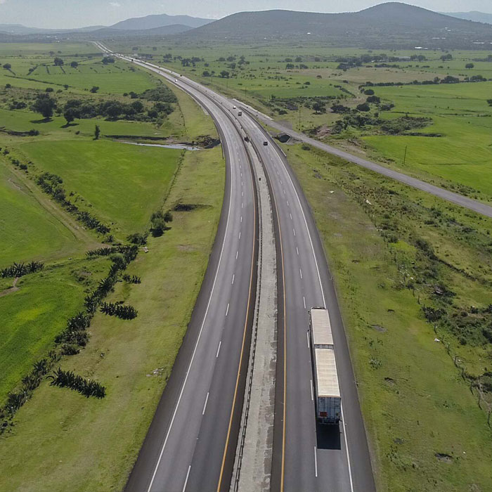
Highway monitoring with drones. Aerial photography and video with drones for construction site testimony, 90 kilometers of road in the Tulancingo – Ecatepec – Pachuquillas deviation.
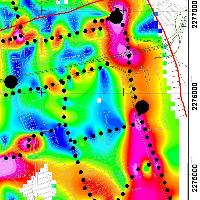
We implement geophysical methods for underground research and exploration. Natural resources and hydrocarbons, mining, construction, urban planning, public safety, archeology and agriculture.
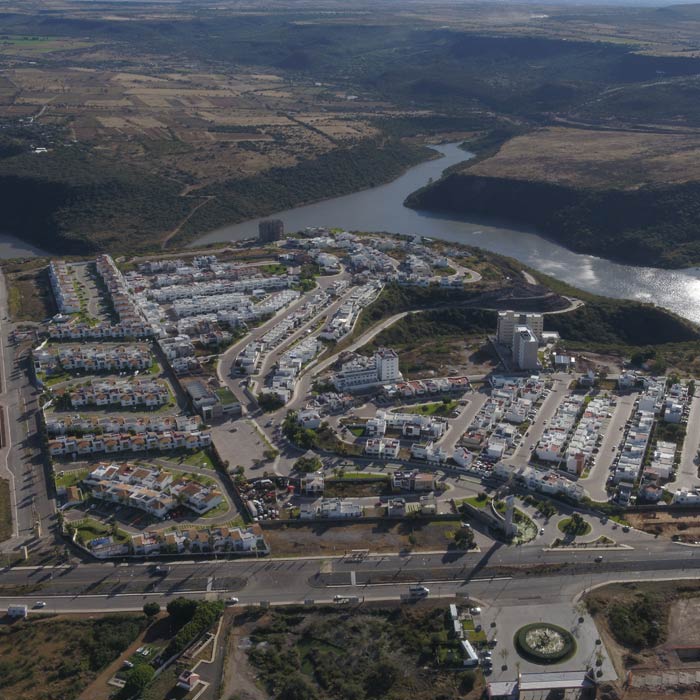
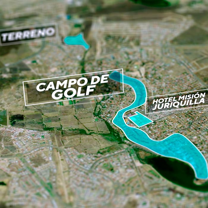
Aerial photography service with drones and aerial video with drones for real estate advertising, Residencial Investti Querétaro
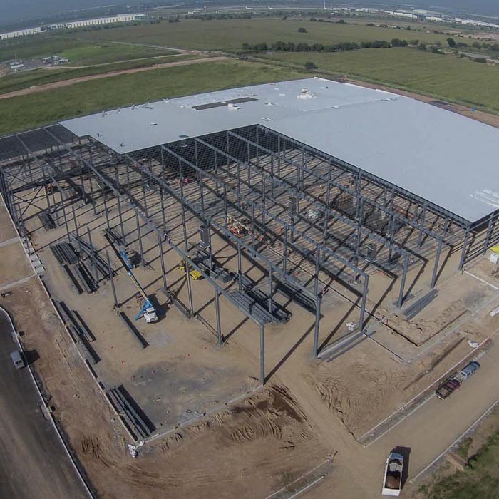
Aerial photography and aerial video with drones for construction monitoring; AeroTech Industrial Park Querétaro.