Loading...
Loading...

Industrial Solutions| Industrial Solutions| Industrial Solutions| Industrial Solutions| Industrial Solutions| Industrial Solutions| News
We participated in the 2021 edition of the Pix4D User Conference with the talk; Digital twin of one million solar panels by Pedro Olivares Sáinz, Executive Director of AV3 AEROVISUAL.
Aerial photogrammetry with drones allows the generation of 2D images, 3D surfaces, and three-dimensional digital models. Photogrammetry has applications in mining, geotechnics, geology, geophysics, civil works, archaeology, among others.
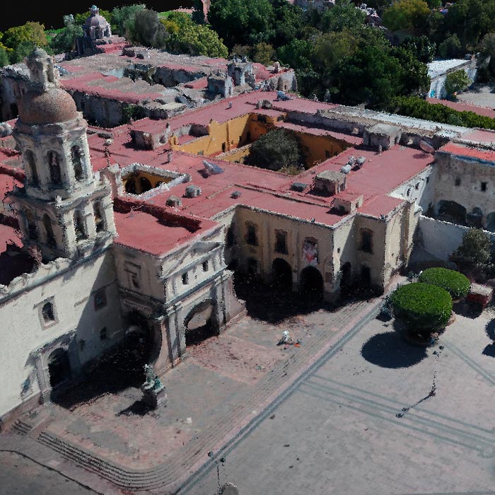
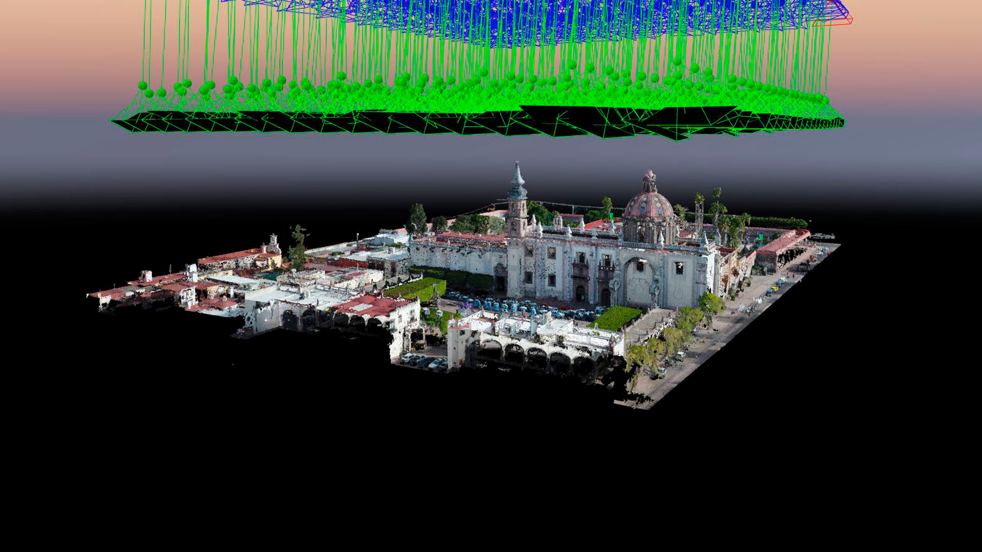
Subsidence study of the Historic Center of Queretaro based on urban microgravimetry, for planning purposes and the conservation of the historic architectural heritage.
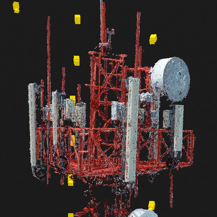
Inspection of telecommunications facilities with drones to optimize maintenance processes. With inspection software, artificial intelligence and certified operators, we deliver valuable information to maximize the capacity and contribute to the transition into 5G technology.
Uncategorized
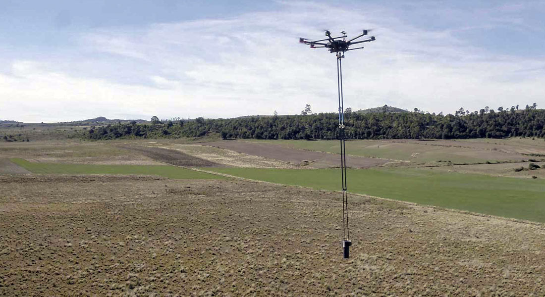
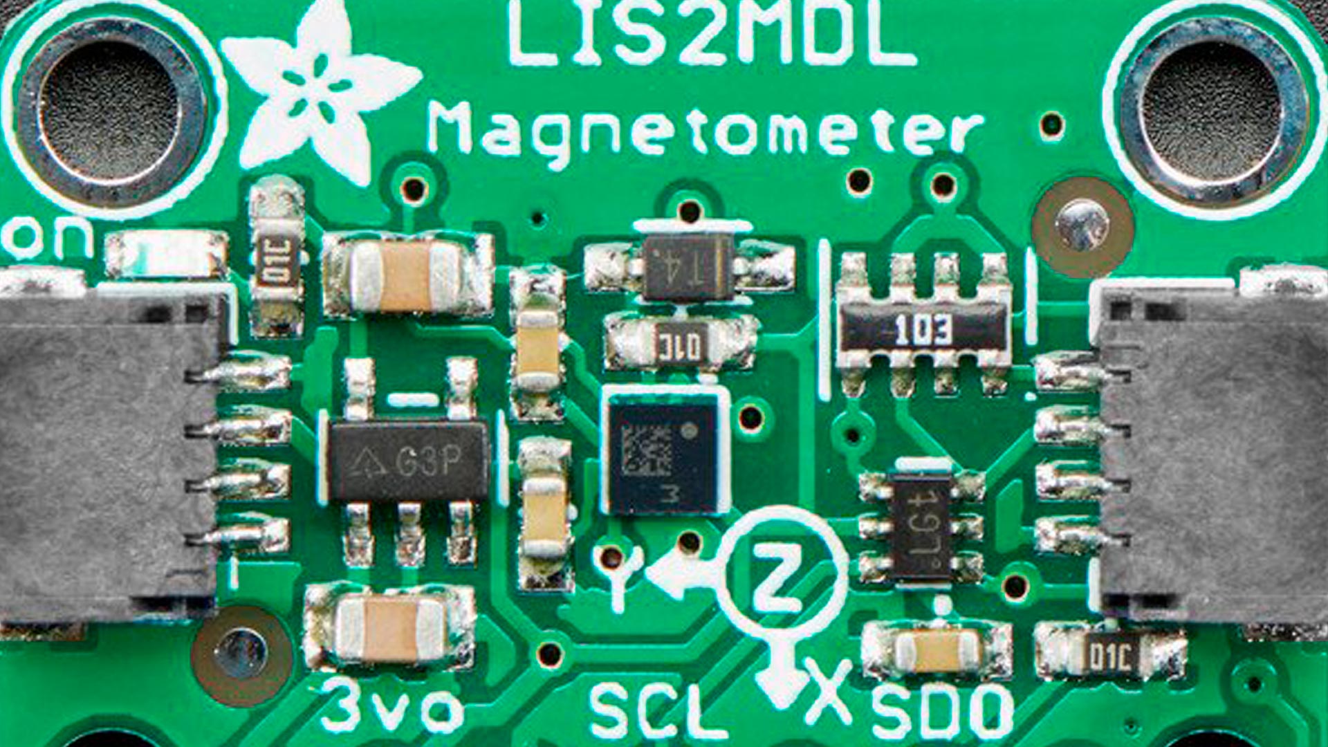
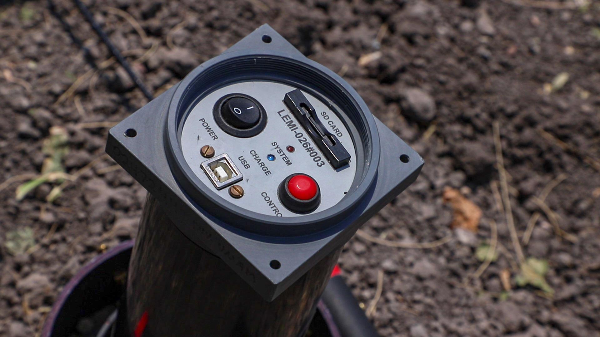
Development of aeromagnetic exploration system with Fluxgate-type magnetometers, transported by a drone in continuous acquisition mode, for the generation of polygons or profiles to obtain magnetic data in all types of areas. Collaboration with UNAM’s CEGEO, the Ukrainian Academy of Sciences and AV3 AEROVISUAL.

Uncategorized
Drones Pro Photogrammetry first annual meeting, held at Tecnológico de Monterrey campus Guadalajara. The event gathered students, researchers, companies and representatives of government institutions and people interested or involved in the use of drones for geophysical studies.
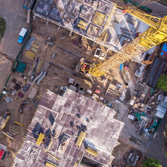
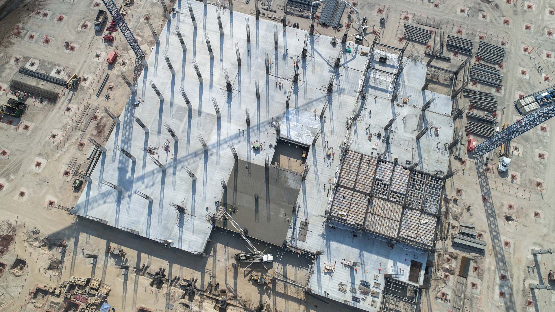
Drone survey, monitoring and mapping services for the construction industry, real estate, urbanism, mining and insurance companies.
Geophysics and exploration| Geophysics and exploration| Geophysics and exploration| Geophysics and exploration| Geophysics and exploration| Geophysics and exploration| Geophysics and exploration| Geophysics and exploration| Geophysics and exploration| Geophysics and exploration
Magnetometry and its application in automation, archaeology, mining, military applications, telecommunications and aerospace.
Uncategorized
Learn about the most commonly used magnetometers for geophysical exploration, their characteristics and the principles under which they work.
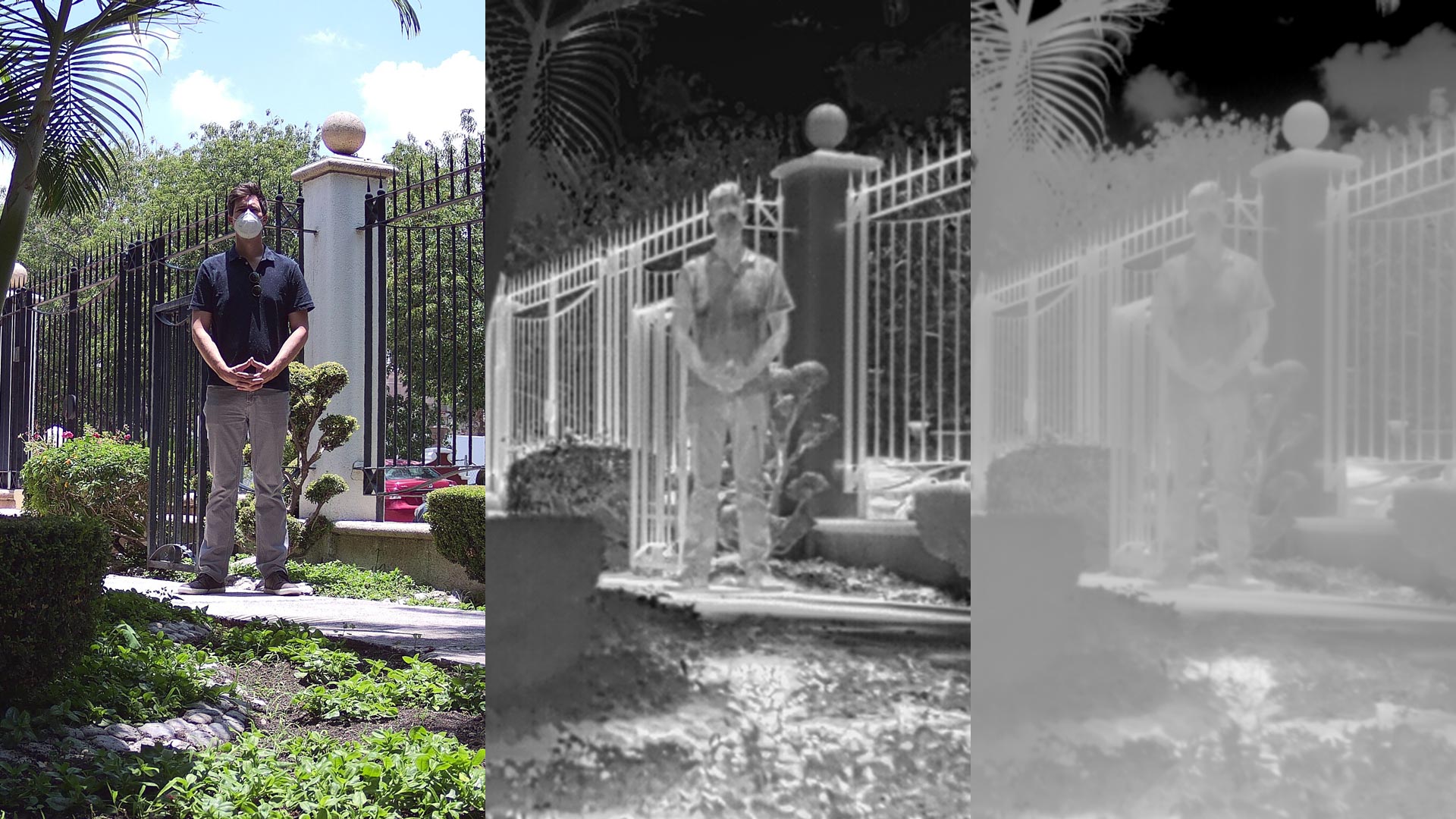
Features and differences between .JPEG, .TIFF and R.JPEG formats, the most common for taking and storing thermographic images in aerial inspections with drones.
Aerial inspection with drones adds value and intelligence for different sectors of the industry, it is a review to prevent, detect or correct some kind of problem. By using a drone, qualitative and quantitative information can be collected from an asset or a location of difficult access, making the inspection safe and efficient.

Uncategorized
The conversation around education and work is essential. Summary of the forum “Education: Professions of the Future”, organized by the technology cluster Vórtice It through the Designio initiative, the first Think Tank for technological innovation and development in Querétaro.
Photogrammetry for digital terrain model generation. Comparison of aerial magnetometry with drones and terrestrial, using microgravimetry and digital terrain model.
Subsidy study at the historical center of querétaro based on urban micro-gravimetry, with the purpose of planning and conservation of the historical-architectural heritage.
Geophysics and exploration| Precision agriculture
Audio-magnetotelluric exploration for the location of wells and aquifers. Geological study and photogrammetric survey with drones to generate a Digital Terrain Model.